| 22 Apr 2020
Application of seismic prospecting to determine the width of influence of surface faults associated to land subsidence – a case of study in the Aguascalientes Valley, México
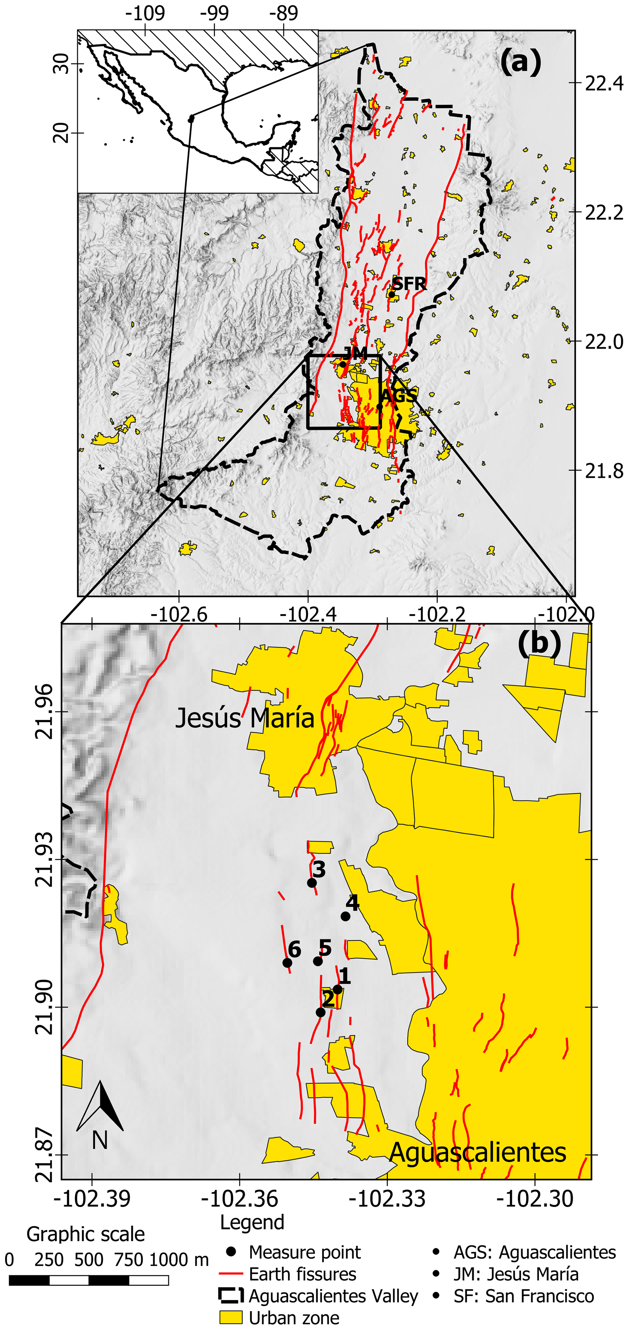
Aguascalientes valley, located in the central part of México, is affected for a land subsidence process triggered by groundwater withdrawal since the 1980's. Currently, the occurrence and the reactivation of surface faults and earth fissures due to differential subsidence, is the main concern for government bureaus dealing with urban planning, because of the damages that these terrain discontinuities are able to cause in constructions and infrastructure. The deformation and rupture process produces an active linear discontinuity with a variable width of influence, where the constructions and infrastructure are prone to get damage. Therefore, the determination of this width of influence is critical for urban planning and hazard determination.
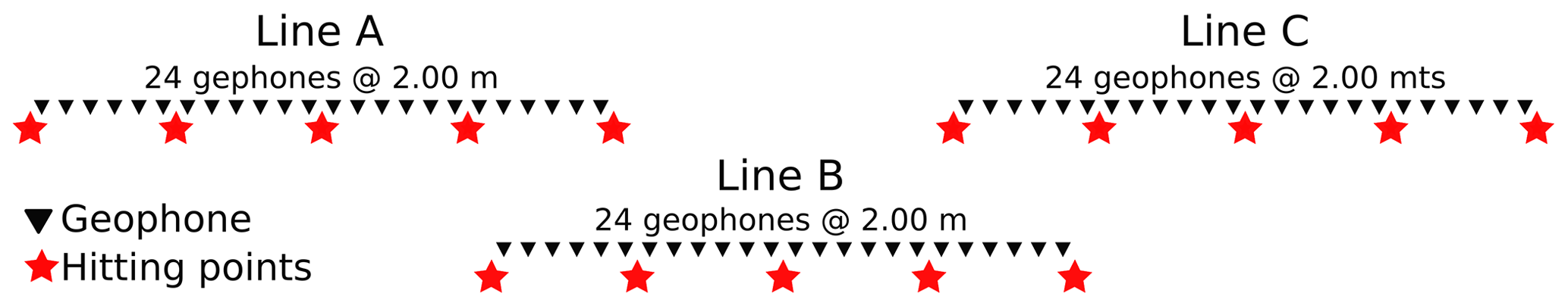
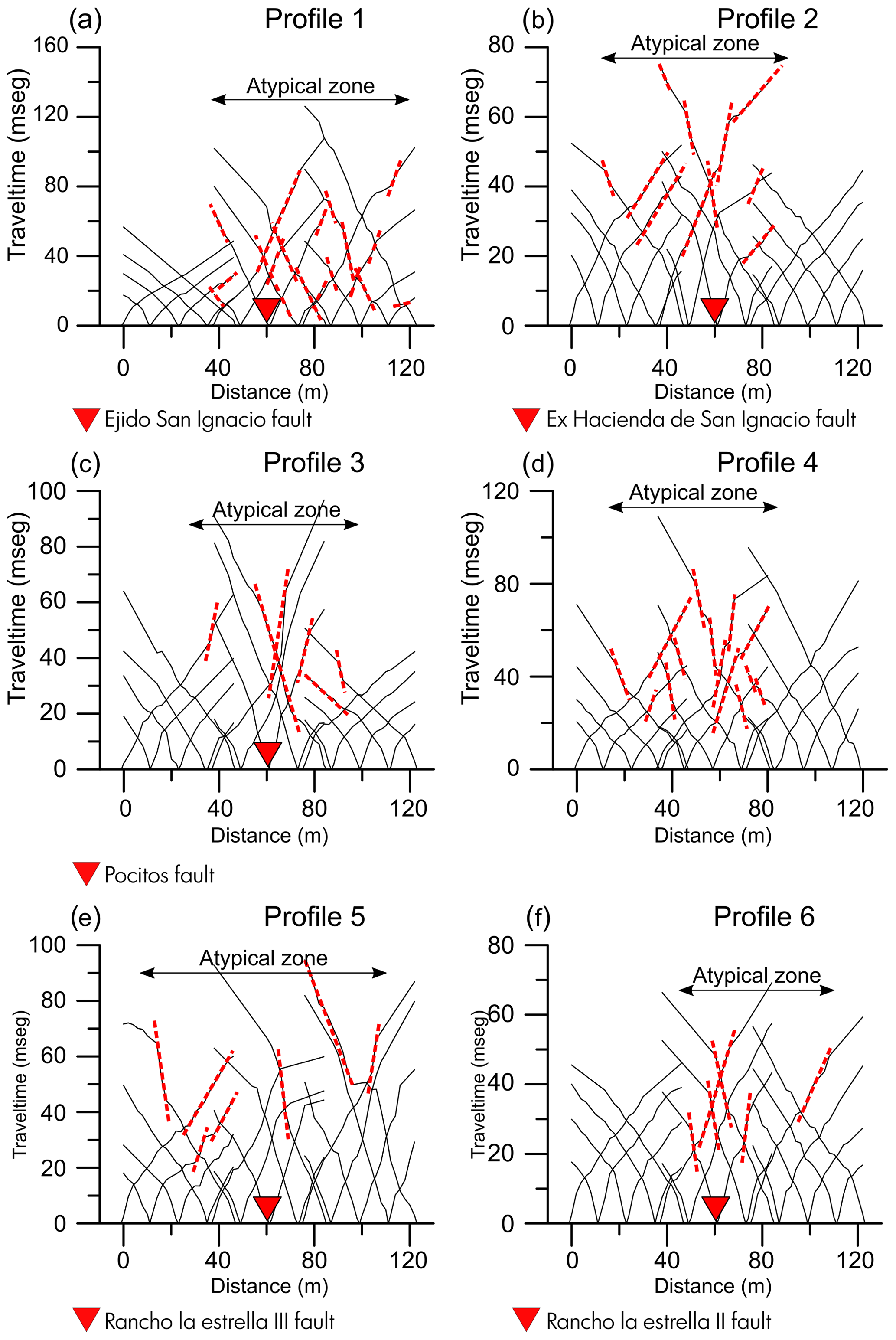
In this work, the results of a geophysical seismic survey carried out in six surface discontinuities located in the subsidence area of the Aguascalientes Valley, are presented and discussed. The study included acquisition of seismic tomography profiles measured perpendicularly to the discontinuities, in order to obtain the P-wave velocity sections. The resulted P-wave velocity models show a low-velocity anomaly within the fracture trace with widths from 50 to 100 m. This anomaly is interpreted as a mechanically disturbed zone due to the activity of the surface fault, this is, due to the presence of fracturing caused to the adjacent material by the differential subsidence. The results suggest that the material in the disturbed zone, is experiencing a increase in secondary porosity, caused by the deformation and rupture process, and the subsequent generation of small fissures and voids.
The results of this study have practical implications because the methodology allows defining the influence zone of an active discontinuity, and therefore, to establish a restricted width along the surface discontinuity. The definition of this restraint zone is a first step to produce a subsidence hazard zoning including not only the discontinuity trace but its width of influence.